Today in my Researching Families in Pennsylvania (RFIPA) course, we learned how to use a land compass and read metes and bounds on a deed (as Pennsylvania is a State Land State and uses metes and bounds)..
On my last research trip to Tioga County, I had printed off many of the Whittaker Deeds from Richmond and Covington Townships that I could find. I’m still working on uploading them and creating a citation – I haven’t figured any of the deeds out yet. So I took my new knowledge from today’s class, grabbed a deed, and attempted to plat out on my own.
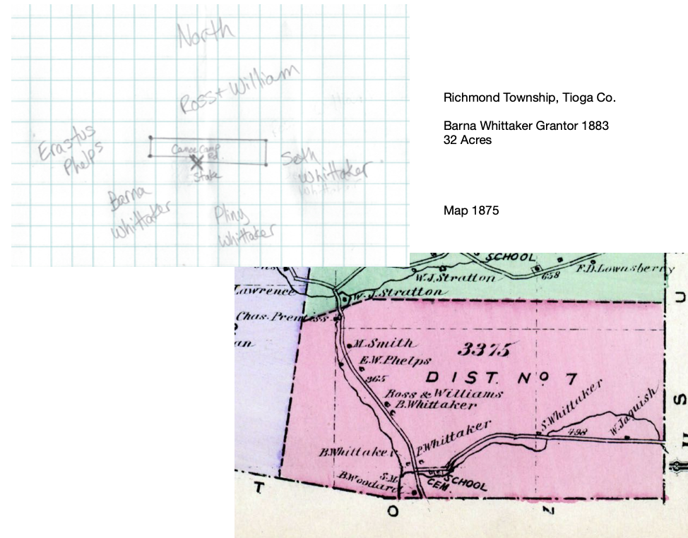
I selected the first one that I could find where my 3rd great-grandfather Barna Whittaker was involved. In this case, he was the grantor for land that he was selling to William E. Whiting on 10 Dec 1883 in Richmond Township, Tioga Co., PA.
I was confused by all of the descriptions of who the property was next to, but when I compared the names to the map from 1775, I think I did a pretty good job for my first try!
Now I need to map out all of the other Whittaker deeds (of which I probably have two dozen…) and create a timeline of when Peter (the dad) owned the land and then when his sons (Barna/Barney, Pliny, and Seth to name a few) bought land and then sold it. It’s fascinating!
Someday! First I have to at least upload all of those deeds to Ancestry and FamilySearch. After all, I have to eat dinner before I have dessert! LOL